About this blog

Just having a bit of fun here, posting about walks and other stuff. I need to get out more.
Showing posts with label Isle of Skye. Show all posts

Monday, 7 May 2012

A Long Walk on the Isle of Skye (Part 5)

Day 6

Loch Sligachan to Portree

I was up and off early this morning, and immediately missed the path to the road end at Peinchorran. Instead, I ended up scaling a few fences on the way over moorland to pick up the coast road before taking the "low" road beside the sea.

It was a grey morning and my thoughts turned to home as I made my way past Balmeanach Bay. I had pre-booked train tickets for the journey home on Tuesday, today was Friday.
This meant the last couple of days from Portree to Rubba Hunnish would need to be rushed and hard going, totally out of context with the walk so far.
I wanted to finish the walk to the northern point on Skye in the same way I had enjoyed the walk so far.

It was at this point that I decided that this walk would end at Portree and that I would return at a later date to continue to the far north or the island in the same leisurely manner that I had enjoyed over the past week.

The landscape of Skye is far too good to rush.


Glamaig from moorland above Loch Sligachan

The Narrows of Raasay

As far as road walks go, this was a little beauty, great views over to Raasay and up the coastline to Ben Tianavaig.
Ben Tianavaig from the Braes

The Braes from memorial cairn
The cairn commemorates a brave battle for land tenure by the former crofters from these parts during the clearance programme in 1882. A bit of research has revealed that this was a very important battle in Scottish clearances history which led to new legislation being written protecting the rights of crofters.

The route from here involved more road walking, breakfast was taken at the Aros centre before I plodded through town to the harbour.


Portree Harbour, Journeys end......for now.

During the planning for this walk I had discovered that a favourite Scottish band of mine, Frightened Rabbit, were playing at the Community Centre in town tonight. I had purchased a ticket for the show and this would bring the curtain down nicely on what had been a great week on Skye.
I dropped on Frightened Rabbit recording songs on the beach at Portree in the afternoon before catching the show later on.
Needless to say, I woke up the following morning with a hangover, I groggily packed up my gear for the last time on this trip and caught the bus to Inverness to begin the long journey home.   

Frightened Rabbit on Portree beach
The Isle of Skye is a remarkable place. Granted, I had been blessed with exceptional weather for almost all of the trip but I have a feeling I would have loved this place in any weather.

Until the next time.....

Swim Until You Can't See Land

A Long Walk on the Isle of Skye (Part 4)

Day 5

Loch Coruisk to Loch Sligachan

The Loch Coruisk wild camp had been something I had wanted to do ever since I had first seen photos of this wild place. I had made the most of it, and stayed awake until late watching the stars appear and drinking on the last of the whisky.
As a result, I enjoyed the best sleep of the trip and woke at about 8 am. I loitered around for a while, marvelling at this spectacular location before finally packing up and setting off walking back along the path beside the Loch.
A soggy path ascends below Sgurr na Srti up the the bealach below Sgurr Hain.

It was another beautiful morning and I was blessed with wonderful views all day.
Loch a' Choire Riabhaich

Coullin backdrop from the bealach below Sgurr Hain

Marsco and Ruadh Stac

Sgurr nan Gillean from River Sligachen
The walk out to the Sligachan Hotel was a pleasure, I passed the only walkers that I had seen on the entire trip, three solo walkers heading in the opposite direction.

The peace and quiet was interrupted at one point by a couple of low flying Tornado's out on exercise.

Lunch was taken in the hotel. Fish and Chips washed down with a few pints of Guinness sat by the log fire in the lounge bar.  
There was no need to hurry today, in fact the entire walk had been a leisurely affair and extended lunch stops and early camps had been a feature of the walk. 

Eventually, I shouldered the pack and pushed on along a lovely path on the north shore of Loch Sligachan to a perfect pitch a mile or so short of the road.

Burn on An Leitir

Loch Sligachan camp.
Glamaig across Loch Sligachan
Another memorable day's walking on the Winged Isle.

Thursday, 3 May 2012

A Long Walk on the Isle of Skye (Part 3)


Day 4 Broadford to Loch Coruisk.

My logistical problems had been solved by paying a visit to the bus stop to read the timetables on the way back to the hostel from the pub. It turns out that on school days there is an early morning bus service from Broadford to Portree via Torrin and other surrounding settlements.
And so at 07:20 I returned to the bus stop on a glorious frosty morning for the short journey along a narrow road to pick up my planned route at Torrin. I was the only passenger to board the bus at Broadford and chatted to the driver who explained that the bus service operated to transport pupils to the only secondary school on the island in Portree some 20 miles or so away.
Despite my disappointment of having to cut out part of the route due to the bad weather the previous day, I had enjoyed the break in Broadford. It is a friendly town with all the amenities I needed and I could see this being a good base for a future visit to Skye.
As it was, I alighted the bus by the shore of Loch Salpin and stood looking in awe at the magnificent mountain that is Bla-Bheinn soaring above the far side of the Loch.
The weather was outstandingly good once again as I set off along the road around the head of the Loch.

Snow capped Bla-Bheinn and the ridge line to Belig

Loch Salpin

Reflections
I followed the B road soaking up the views in all directions as far as Kirkibost where I turned off on a minor road, alongside the river to the beach at Kilmarie. An early lunch, which was becoming a feature of this walk, was taken looking out over Loch Salpin towards the west coast of Sleat that I had walked two days ago. 
I called in at an atmospheric old graveyard before continuing the walk along tracks and paths just above the coastline to Glasnakillie to pick up the minor road to Elgol.

This is the road to Elgol
I called in at the shop on the way into the village which also doubles up as a  tea room and stocked up on half price, out of date  Mars bars and enjoyed mugs of tea and coffee cake sat outside in the mid-day sunshine. 
While in the pub last night, I had researched the Elgol-Loch Coruisk boat trips on my smart phone and I had phoned Stuart at Misty Isle Boat Trips who explained that the boat ran trips all day and that a ticket could be purchased for a one way trip only. This had not been on my original route plan but I quite fancied the idea of travelling in to Loch Coruisk by boat. 
I made my way from the tea room to the jetty to await the next Misty Isle boat.

The Coullin Hills from Elgol beach

My idea of heaven
I had an hour or so to wait for the Misty Isle to return to Elgol and spent the time chatting to Anne in the kiosk and lazing about on and around the beach taking photos of the Isles of Rum and Soay and the stunning Coullin Hills. 
Eventually the beautiful Misty Isle returned to the jetty and I boarded the boat along with a few other passengers for the short journey across Loch Scavaig to Loch Coruisk.

Stewart  entertains whilst dad Seumas skippers the Misty Isle


Emerald lochans on the approach to the landing point 


Loch Coruisk and some joker

Unspoilt view of Loch Coruisk

Looking back, from the path by the Loch


Wild camp at the head of the Loch
Looking towards Sgurr na Stri from the best camp site in the World (probably). 

Waiting for the stars 

Cuillin skyline


All in all....not a bad day at all.

Monday, 30 April 2012

A Long Walk on the Isle of Skye (Part 2)

Day 2. Inver Dalavil to Loch Eishort

It was another cold night in the tent but I had a better night's sleep and awoke to another glorious morning on the Isle of Skye. I opened the tent to the sight of another clear blue sky and hardly a breath of wind.

I had a leisurely breakfast and eventually packed up and set off walking at about 08:00. The walk today was to be almost entirely along the west Sleat coastline and the views to the Cuillins were first class all day.
The first three miles were quite strenuous, there is a vague path in places but generally this section is rough going and time consuming just picking out a route above the shoreline.

West Sleat coastal scenery

I reached the beach of Tarskavaig Bay and chatted to a lady out walking her dog, she warned me of impending heavy rain and gales, forecast to move in from the west at about 5pm. It was hard to believe this news given the stunning weather so far on the walk.

Tarskavaig

The next section of the walk follows the road to Tarskavaig and Loch Gauscavaig to Ob Gauscavaig, which is a stunning little bay with great views of Bla-Bheinn and the Black Cuillins, an ideal spot for a rest and a lazy lunch. 

Loch Gauscavaig

Mindful of the impending storm I decided to make the best of the good weather and detour slightly to the ruins of Dunscaith Castle which is beautifully situated at the entrance to the bay.

Dunscaith Castle ruins
The main stairway to the castle has long since collapsed but it is possible to tiptoe along a ledge to gain access to the top of the castle ruins. The views from here were the best of the trip so far.

Wow factor goes off the scale
Rather than retrace my steps back to the road I decided it was time for a bit more rough stuff and headed out over Druim Dubh, knee deep heather bashing, deer fences and the occasional boggy bits led me to another lovely bay at Inver Aulavaig. This would have been a great place to camp but I decided it was too early in the day and  wanted to push on a bit further if the weather was about to break as forecast.

Inver Aulavaig
Approaching Ord
More of the same rough coastal walking took me to the small settlement of Ord.
It was impossible to rush any part of the walk today, the views were quite simply breathtaking and improved with every step taken. Many times I paused to soak it all up. I temporarily left the sea behind at Ord and took the road out of the village for about 1km, I then ascended to half height of Sgiath-bheinn an-Uird, a magnificent block of white quartzite stretching for 3km from above Loch Eishort.

Sgiath-bheinn an-Uird
I didn't have the time to visit the top of this hill today and instead followed a faint track which traverses below the hill to some lovely woodland before descending to Loch Eishort at the outflow of Allt a-Chinn Mhor where I pitched the tent.

Loch Eishort Camp
It was not yet 4pm but I decided that this spot would do just fine and I pottered about on the beach doing nothing much at all.
I managed to get a few text messages away and blogger Carl Mynott confirmed the weather was about to take a turn for the worse for the next 18 hours or so.
At just before 8pm the first drops of rain hit the tent, the wind stiffened significantly and I lay looking out at the Loch reflecting on a great day. Just at that moment a fox trotted down from the woods behind the tent to the Loch side less than 30 yards away from me, I reached for the camera but before I had time to take a photo, it sensed my presence and quickly ran back to the cover of the woods.
Eventually I zipped up the tent and drifted off into a deep whisky induced sleep.

Day 3. Loch Eishort to Broadford

Considering the conditions I had slept like a log apart from one or two occasions when the wind and heavy rain were at their most ferocious. 
When I unzipped the tent for a call of nature at about 5.30 I realised just how heavy the rain had been. The level of the Loch had risen significantly and the Allt a-Chinn Mhor, which had been nothing more than a trickle last night, was now in full spate.

Water morning
I didn't hang about this morning and was packed up and walking before 07:00. I had concerns that the planned day via Heast, Boreraig and Suishnish may well be dangerous in these spate conditions, I was proven right as it took me almost two hours to walk a mile and a half to the stony beach below Drumfearn. There were many more burns on the ground this morning than were shown on the map and all were raging torrents posing problems to cross. It was raining again now as the time had come to make a decision.
Without further ado, I bailed out along the minor road to meet the A851 and hitched a lift to Broadford Backpackers Hostel where I spent the night..
By the time I had got cleaned up, done a bit of shopping in the Coop and had some fish and chips, the weather had reverted to clear blue skies again as if the storm had never happened.
I was now off route and left with the headache of trying to get to Torrin early the next day to continue the walk.

Sunday, 29 April 2012

A Long Walk on the Isle of Skye (Part 1)

Loyal followers of this blog (both of you) may be aware that I had decided to take a year off from the TGO Challenge this year to take a shorter, more leisurely backpacking trip in an area outside of the TGO Challenge boundaries and I had latched on to David Paterson's excellent book "A Long Walk on the Isle of Skye" which describes a route from Armadale in Sleat  to Rubha Hunish which is the most northerly point on Skye. I had tweaked Paterson's route slightly to include a visit to the Point of Sleat on the first day of the walk, thereby enabling a most southerly to most northerly walk on Skye.
The details of the route plan can be found in a previous posting on here... Link to plan

This is the story of my Long Walk on the Isle of Skye.

The Journey to Skye.
I travelled up to Skye on Saturday 14h April firstly on the early morning train out of Doncaster to Glasgow then on the familiar 12.20 Glasgow to Mallaig train.
 I have caught this train several times over the years, usually when travelling up to one of the TGO Challenge start points on the west coast.
The station concourse  on these occasions is always full of happy, smiling Challenge entrants and the event starts here, among friends.
This time there were no friendly faces, no Roger Smith to shake my hand and wish me well as I passed through the gate onto platform four to board the train.
Somehow, it just didn't feel right this time, just not the same sense of excitement and anticipation for the long walk ahead of me.

I started to relax soon enough as the Highland scenery on this classic rail journey started to take hold of my emotions and by the time the train split in two at Crianlarich I was in full holiday mode and relishing the thought of a long walk on the Isle of Skye.
The entire journey is superb and one that I will never tire of making, memories of previous Challenges and Munro days came flooding back as the train made steady progress to stations such as Bridge of Orchy, Rannoch and Corrour.
From Fort William onwards to Mallaig the scenery is just breathtaking and I was fortunate to have clear blue skies all the way to Mallaig.
There was a strong bitterly cold northerly wind blowing straight into my face as I walked over to the ferry terminal ticket office where I bought a one way ticket to Armadale and boarded the MV Coruisk for the short journey across the Sound of Sleat.

Heading for Skye 

Knoydart from the ferry
Finally, after 13 hours of travelling I set foot on the Isle of Skye.


In true Challenge tradition, the first point of call was the pub... The Ardvasar Hotel where pan fried scallops were devoured, washed down by a few pints of Guinness.
I had spotted a few potential pitches quite close to the sea as I was walking up to the hotel and eventually I reluctantly left the warmth of the lounge bar and made my way back towards Armadale.

Scouting for the ideal pitch
The wind had thankfully dropped but it was still a cloudless and bitterly cold evening. I managed to find a sheltered enough spot close to the sea, put my tent up in the fading light and huddled deep inside the sleeping bag looking over to the mainland and the twinkling street lights of Mallaig.

The walk.
Day 1. Armadale to Inver Dalavil
I slept fitfully, waking several times during the night feeling cold and uncomfortable, finally at around 6am I decided to get a brew on and start to prepare myself for the first days walking. It was a glorious morning outside the tent, not a cloud in the sky and the Sound of Sleat was like a mill pond, Oyster Catchers noisily went about their early morning business flitting up and down along the foreshore of the bay.
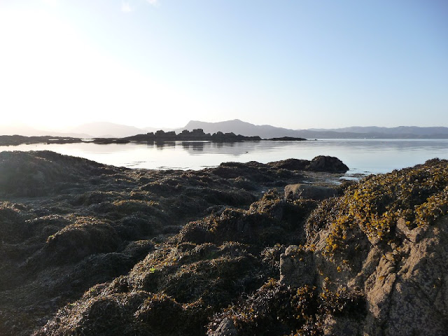
Early morning tranquillity 
It was 08.30 when I eventually left the bay and set off back along the road towards the hotel.
The road walk out to the the scattered community of Aird of Sleat is pleasant enough with the south Sleat coastline always in sight on my left, the air was full of the sounds of birdsong and nothing else. At one point I startled a roe deer and it elegantly hurdled over a fence and disappeared under the dense canopy of Tormore forest.

The road ends abruptly at a steel gate, beyond which there are the scrapped remains of cars and tractors quite out of character with the surroundings. Once past this eyesore the scenery improves again, good views open up of the isles of Eigg and Rum as the track undulates towards the Point of Sleat. 
A Scottish Rights of Way signpost indicates the point at which to leave the track and follow a path out towards the lighthouse at the Point of Sleat. As I made my way along the path a Buzzard took to the sky from its perch quite close by and noisily circled above me, I can only assume that the nest site was on the nearby crags of Creag Mhor given the raucous behaviour of the bird.
Just a short distance further along the path starts to descend towards the most idyllic white sanded bay imaginable. This is the much photographed beach of Camas Dariach. 

Sandy Bay, Camas Dariach
It was only 10.30 but I decided that this was the just the most perfect spot to get the stove on and have an early leisurely lunch. After all, it's not often that you have a paradise like this to yourself. I spent about an hour here, just strolling along the beach or sitting on the rocks listening to the gentle lapping of the waves breaking on the virgin sand.
Of course, all good things come to an end and I shouldered my pack and made my way back along the path for a short distance before branching off up and over the headland to the Point of Sleat.

Point of Sleat lighthouse
The old lighthouse was demolished in 2003 to make way for this concrete structure, the light is solar powered and would probably be fully charged given the clear blue skies today.

Solar panels on the lighthouse 
The lighthouse is not particularly pleasing on the eye but that is more than made up for with the superb views over to the Isles of Rum, Canna and Eigg. 

The Isle of Rum from Point of Sleat
To pick up the route over to Inver Dalavil involved retracing my steps back along the path to regain the track towards Aird of Sleat . After about 1km I left the track to follow a burn up to Loch Aruisg, this was pathless rough walking, a mixture heather bashing and bog trotting.  
Loch Aruisg
I followed a deer fence for a while to link up Loch Horaveg and Loch an t-Seilich. Superb views of the Cuillins began to open up and eventually I descended from the Bealach Garbh to paddle across Allt a' Glinnhe and set up camp close to the outflow to Inver Dalavil. 
It was only 4 o'clock but the camp site was too good to pass by. Following dinner I spent my time wandering around on the rocky shoreline soaking up the views. Curlews, Oyster Catchers, Shag and assorted Gulls had made this part of Sleat their home as had about half a dozen Seals who sempt totally oblivious to my presence as they fooled around in the bay.

Fine views of the Cuillins 
I could not have hoped for a better days walking on my first ever visit to Skye. I sat and reflected on the day as the sun dropped below the horizon.   

Sunset, Sea of the Hebrides

Thursday, 2 February 2012

The Isle of Skye "Toe to Tip". The plan

10 years ago, while studying for a degree at Sheffield Hallam University, I managed to win an award.
I can't remember the reason for winning the award now, but I do recall having it presented to me at the Cutlers Hall in Sheffield. It was all very posh and I stood out like a sore thumb as the only wrinkly amongst a crowd of fresh faced and very bright, young engineering students. 
The award was a £500 allowance to travel to Europe to spend a few days at participating Engineering company of my choice, with a £50 book voucher thrown in to help me along with my studies.

Toulouse was very nice and the staff at the Rolls-Royce office there were very accommodating. 

When I returned, I trotted off to Waterstones bookshop on the university campus and bought 2 books. "Fatigue and the Applications of Fracture Mechanics" and "A Long Walk on the Isle of Skye" one of which they had in stock, and one of which I had to order.

I never did get around to reading the Fracture Mechanics book but I'm sure it is a very interesting read...maybe one day when I have a bit of spare time?. 

I have however, read and marvelled at the stunning photography of  "A Long Walk on the Isle of Skye", written by David Paterson, many times over the last decade and always had it in the back of my mind as the inspiration for a long walk on Skye if the opportunity presented itself. (link to book)

Having decided to have a break from the TGO Challenge this year to do something else instead that does not use up most of my annual holiday allowance, I now have perfect opportunity to visit Skye for the first time and follow in Paterson's footsteps.

The book details a route starting at Armadale, which is handy for the Calmac ferry from Mallaig, and heads initially over moorland to the western coast of Sleat, it then follows the coastline through the settlements of Tokavaig, Ord, Heaste and Torrin. There is then an opportunity to bag the Munro, Bla Bheinn (Blaven) before heading for the magnificent setting of Loch Coruisk and onwards to Sligachan. 
More coastal walking beside Loch Sligachan and the Narrows of Rassay to Portree for an optional well earned rest day before tackling the Trotternish ridge, and the long final day's push to Rubha Hunish. 

In the main, I plan to follow Pattersons route, with the exception of the first day, when I plan on walking or hitching to the Point of Sleat, thereby enabling a "most southerly" to "most northerly" point to point walk on the island.
I will be wild camping all the way, except for a night on the camp site at Sligachan and maybe a b&b in Portree. 

Although the walk is less than 100 miles long, I fully expect this to be as tough as any long distance walk that I have ever done. Much of the walk is pathless from what I can gather and the first few days especially, are very committing, with no bail out options of  a hotel, b&b or even a bothy if the weather is rough. The going underfoot will be testing to say the least and some river crossings may well be impossible if in spate resulting in lengthy detours.

So that's my big walk planned for this year, I just have the minor details to finalise. The route is sorted and train tickets are booked for April 14th from Doncaster to Mallaig,......now where did I put that other book?